Backyard Home Data Explorer
This project is part of an ongoing research initiative of SCI-Arc’s UPF that looks at how machine learning and Neural Network (NN) platforms might be leveraged to address critical issues within the built environment, with specific interest in the future of equitable housing. Research and platform development pairs machine learning with housing policy and design with the intent of finding innovative ways to reinvent and disrupt bureaucratic systems that often fail to keep pace with housing needs and the changing culture of cities. Los Angeles County is the primary locus; however, findings and methodologies are applicable across densifying urban areas nationwide. Initial research utilizes NN platforms to analyze publicly available data (Google satellite imagery and data sets provided by Los Angeles County) in search of sites in Los Angeles suitable for Accessory Dwelling Units (ADUs), and then automate the design of prefabricated flat-pack housing.
Research objectives: 1) To analyze the scale and feasibility of introducing ADUs in residential neighborhoods of Los Angeles, which demonstrates how to optimize existing land use and thus eventually increase the supply of compact and affordable housing; and 2) To develop and make publicly available an interactive app that allows the user to simulate variable impacts on the City of Los Angeles with a new range of dwelling habits and physical frameworks, which can be applied to other cities or counties.
In summer 2020, the work-to-date was recognized by Pando Populus with an award that signaled out the research as “environmental, technological, philosophical, and moral.”
In spring 2021, Mimi Zeiger and Casey Rehm taught a seminar AI + ADU as part of this research initiative. Below are selected images and descriptions of students’ projects.
GROUP 1
ADUs Without Borders
Daniela Cadavid, Charlene Chen, Emily Dinnerman
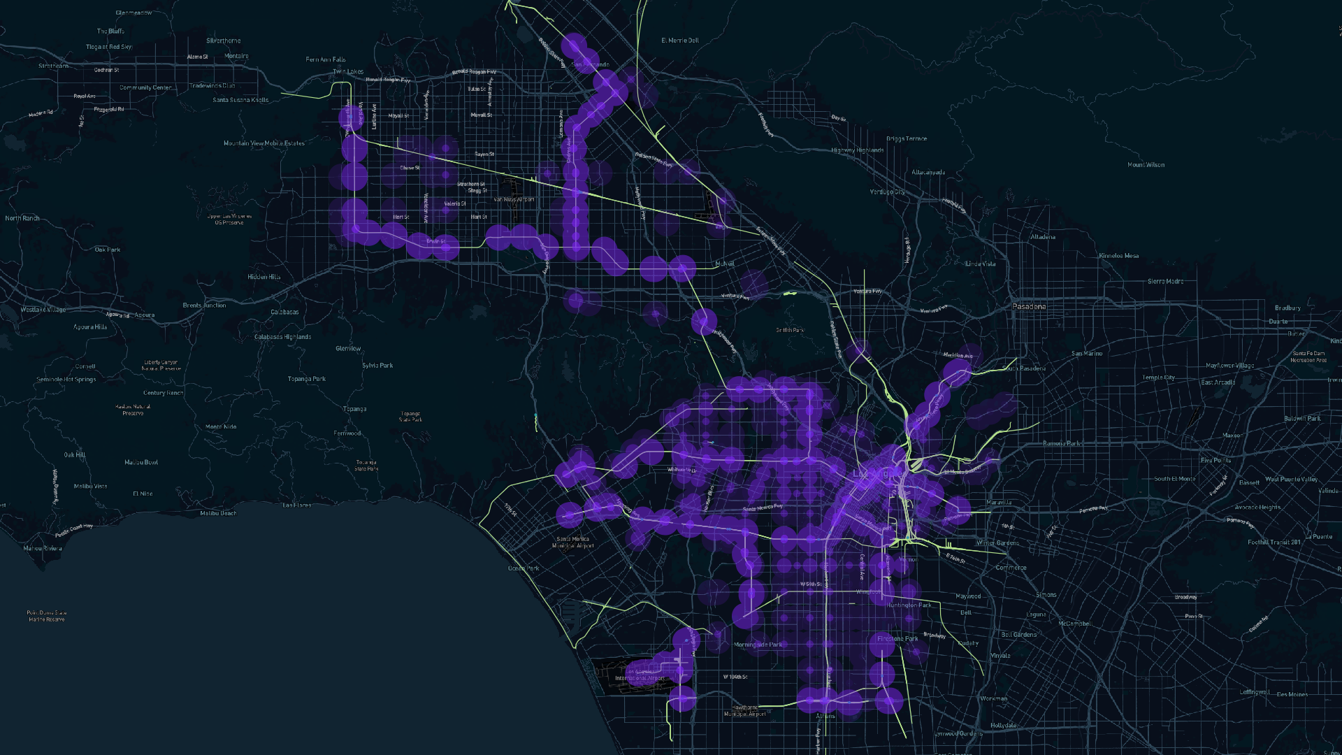
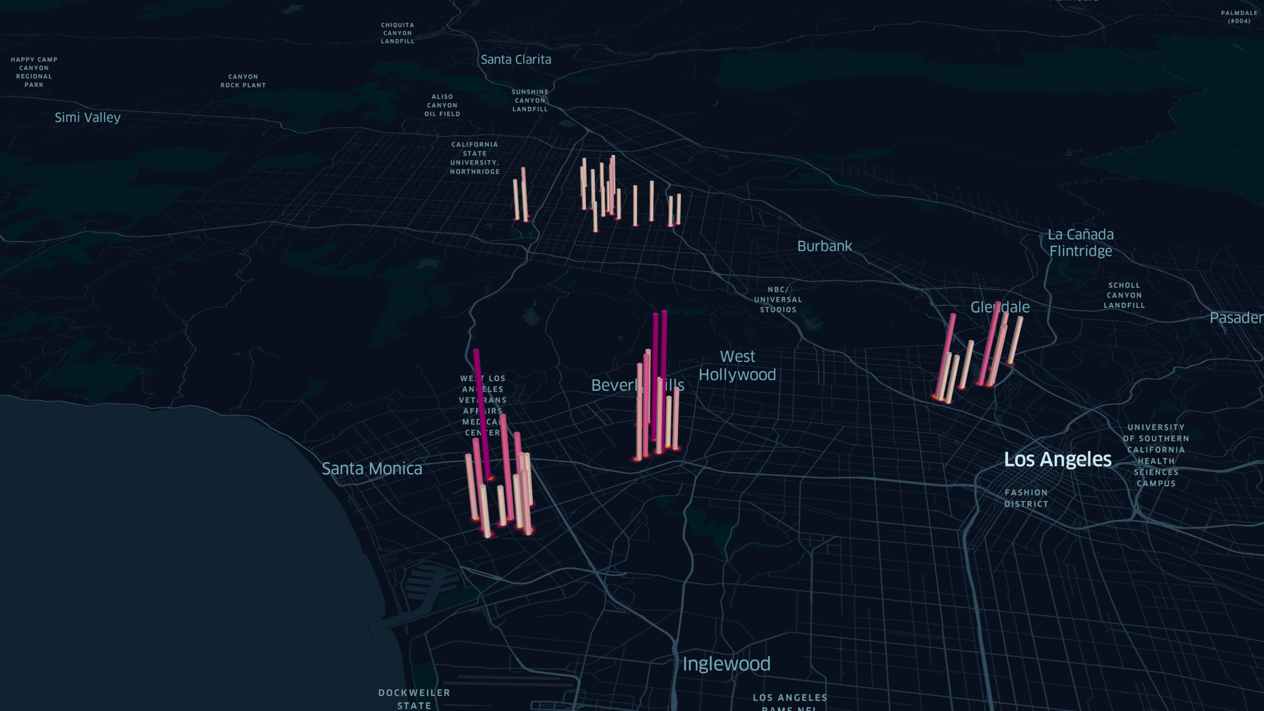
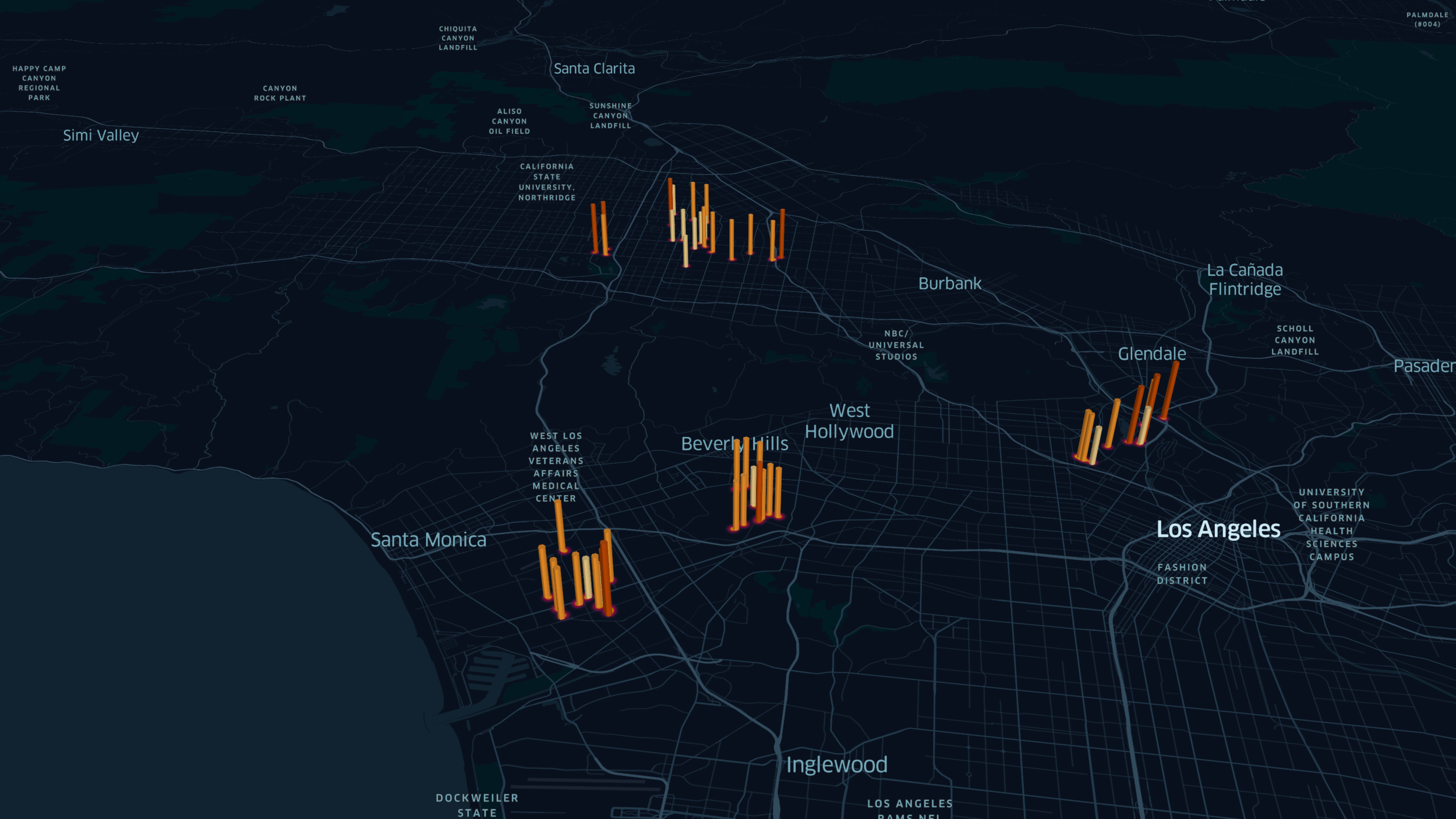
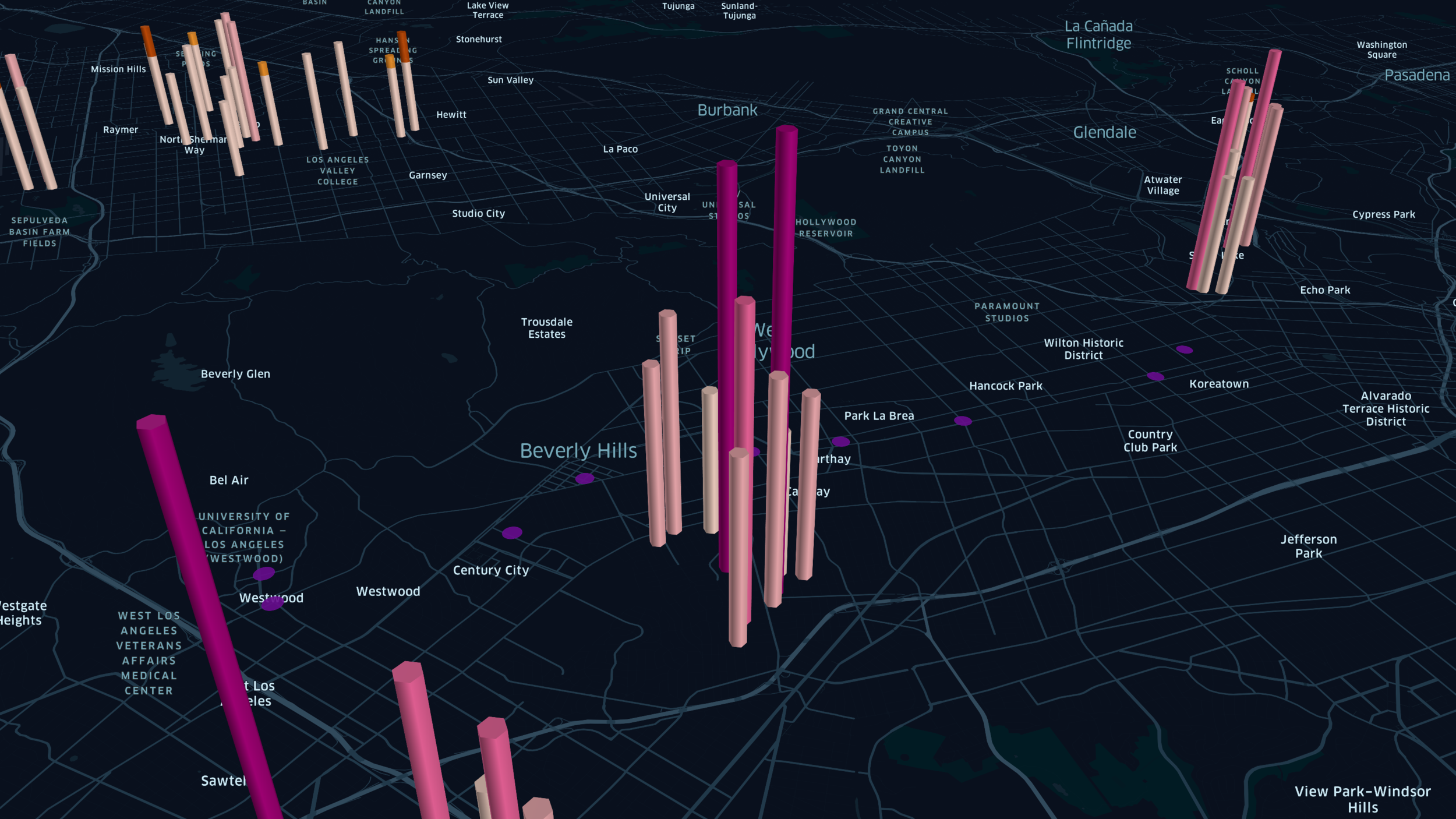
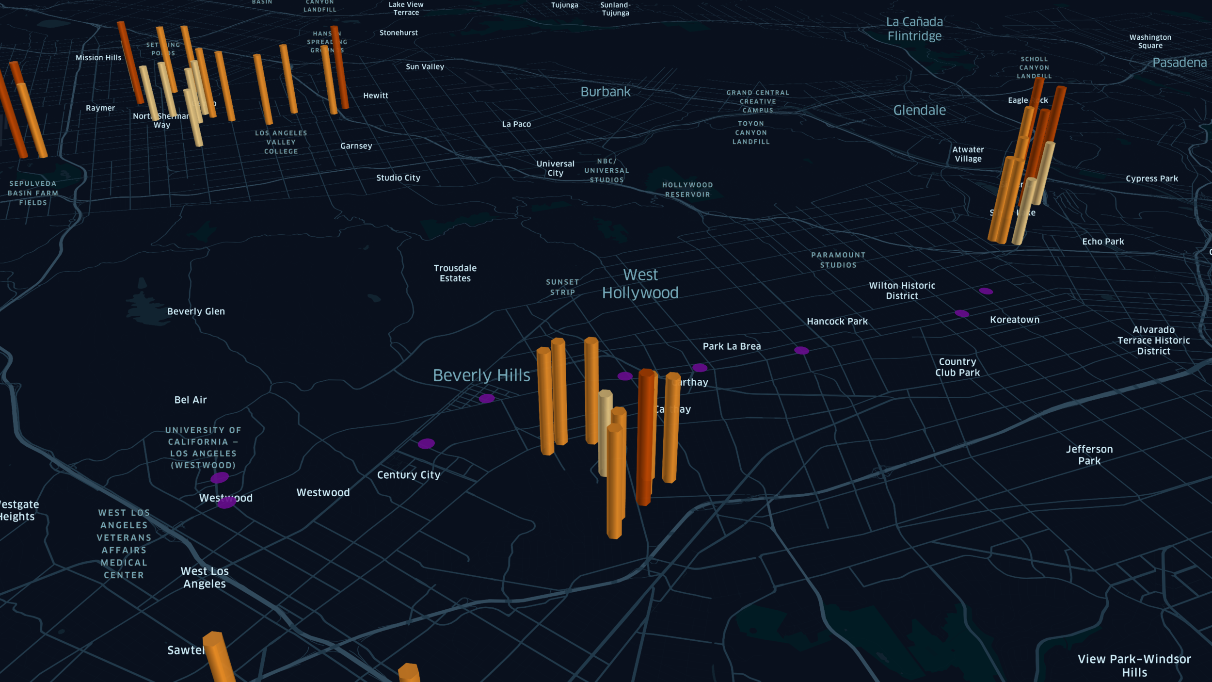
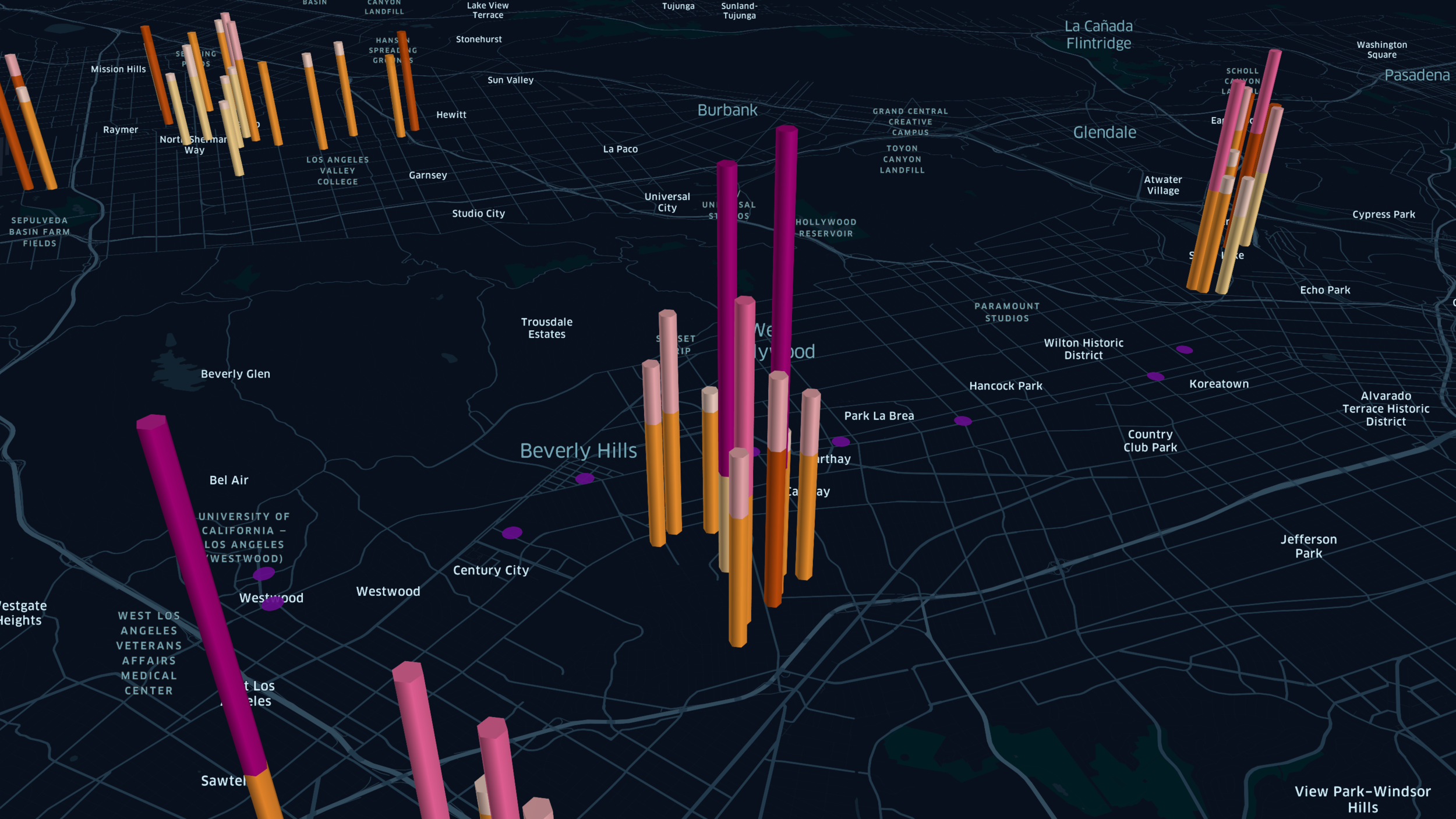
ADUs Without Borders addresses the need for affordable housing options in relation to current and planned transportation within Los Angeles County. As of April 2021, L.A. County zoning laws require an additional parking space for homes located more than a half mile from a major transit stop. Homes inside this radius are considered a part of Transit-Oriented Communities (TOC) and are exempt from parking requirements. In light of the affordable housing crisis, this project seeks to provide a solution for fast-tracking accessory dwelling unit (ADU) development in neighborhoods outside the current TOC boundary by expanding the boundary with the possibility that this could add more homes to the affordable rent pool.
With an emphasis on LA Metro routes, specifically the planned Purple Line extension in Beverly Hills and the Gold Line extension in East L.A., the project team developed an image classifier neural network to study feature differences between TOC and non-TOC homes. They classified 200+ two-bedroom rentals into five price ranges at $500 intervals. The neural network outputs home rental values with a 65% accuracy rate. The results of ADUs Without Borders point to some uninvestigated and confounding factors that contribute to home value, such as food deserts, proximity to amenities, and neighborhood reputation. Future research could contextualize the data further with these additional factors to develop a more robust home rental-value evaluating algorithm.
GROUP 2
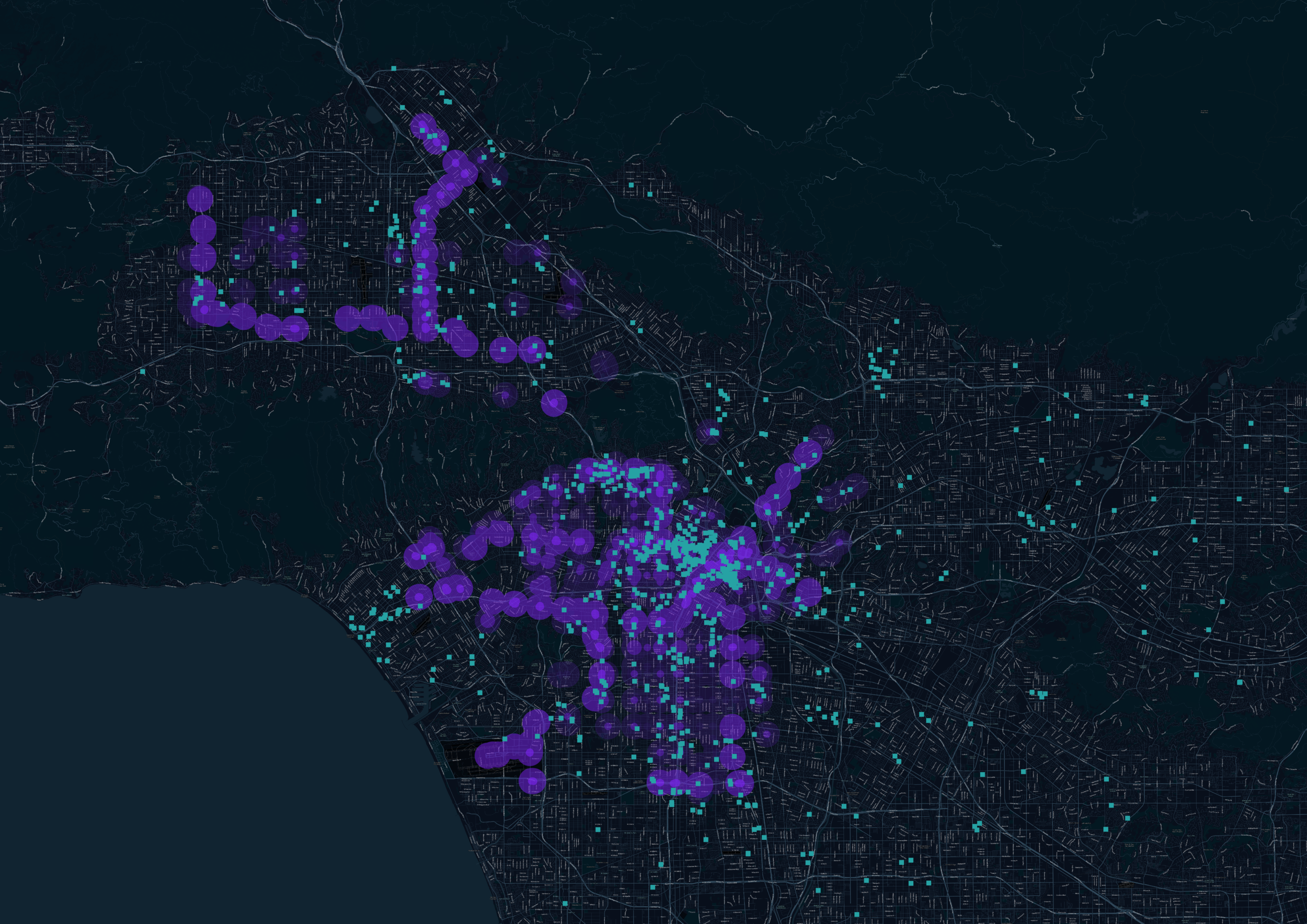
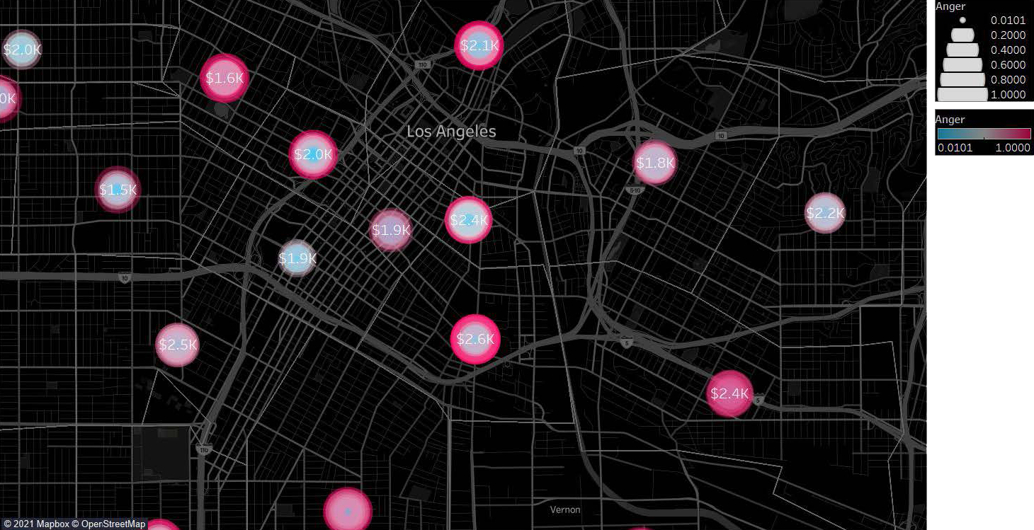
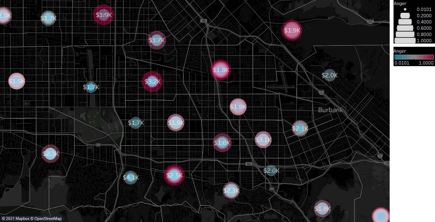
Amenity and Equity: Examining Layers of Rent Prices and Amenities
Giovanna Penna Lima, Matthew Pak, Tiffany Yu
Amenity and Equity investigates the role of amenities, like supermarkets, in sustaining equitable communities or contributing to rising housing prices. The project stems from Kroger’s departure from Long Beach due to pandemic requirements for higher wages for supermarket workers. The sudden lack of an amenity led to a consideration of roles of food when studying about housing and equity; so, the team examined the supermarket's impact on communities.
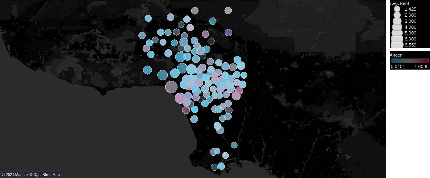
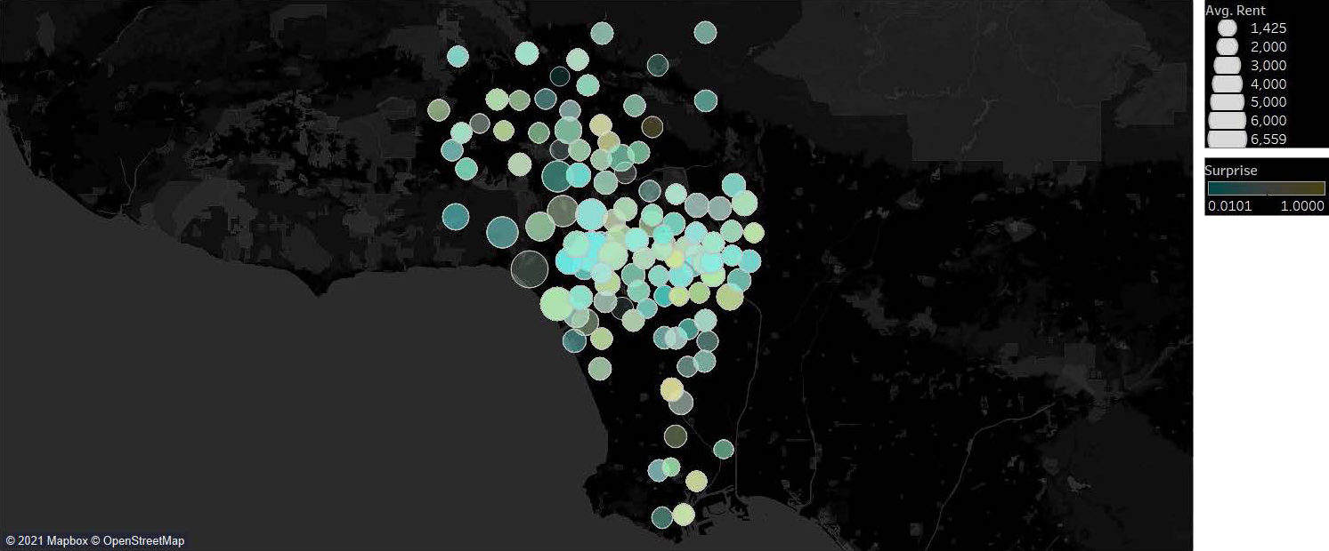
The project examines correlations between rent prices and amenity with the goal of developing new insight to be used when deciding how and where to locate ADUs and amenities.
Two premises govern this investigation into the role of amenities, 1. Adding an amenity improves sentiment (as voiced publicly on Yelp) in a community 2. Positive sentiment impacts rental prices. If both proved valid, there could be a case for ADUs and amenities: ADUs rent income could be improved with the addition of an amenity.
Grocery and supermarket amenities in a community can combat food deserts, promote wellness, and provide local jobs. ADUs can help support stable, equitable neighborhoods, as income from the rental unit contributes to household income or offsets a mortgage. Homeowners who might have capitalized on their property by selling and leaving their community are able to stay in place.
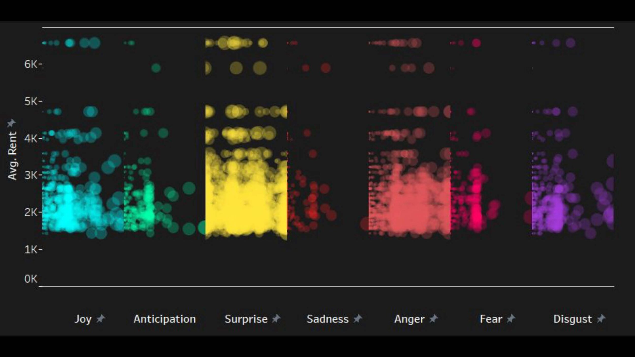
The AI development and sentiment analysis uses a tertiary approach:
The analysis of rent and building types focused on Zillow, with each zip code assigned a median value by building type.
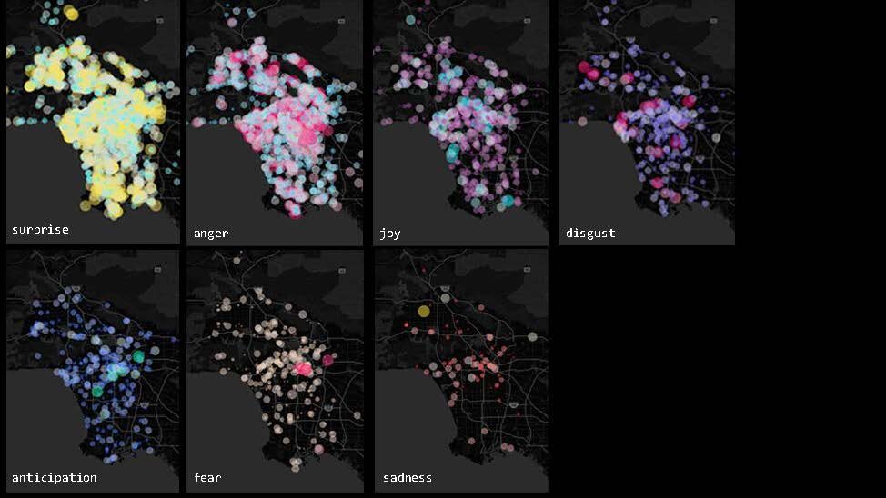
Sentiment analysis relied on a Yelp dataset.The Yelp dataset comprised a merging of 479 zip codes with 13 different categories related to grocery stores, including “bakeries” and “public markets”. For each business, sentiment analysis was applied to three reviews by Yelp users.
By using a train Estimator made by Twitter, it was possible to cover which business had more probability of having a specific emotion, such as “joy”, “anticipation”, and “anger”.
GROUP 3
Solarpunk Community and Eco-speculation
Qihang Fan,Yuhong Gong, Shuai Ma, Runhuan Wang
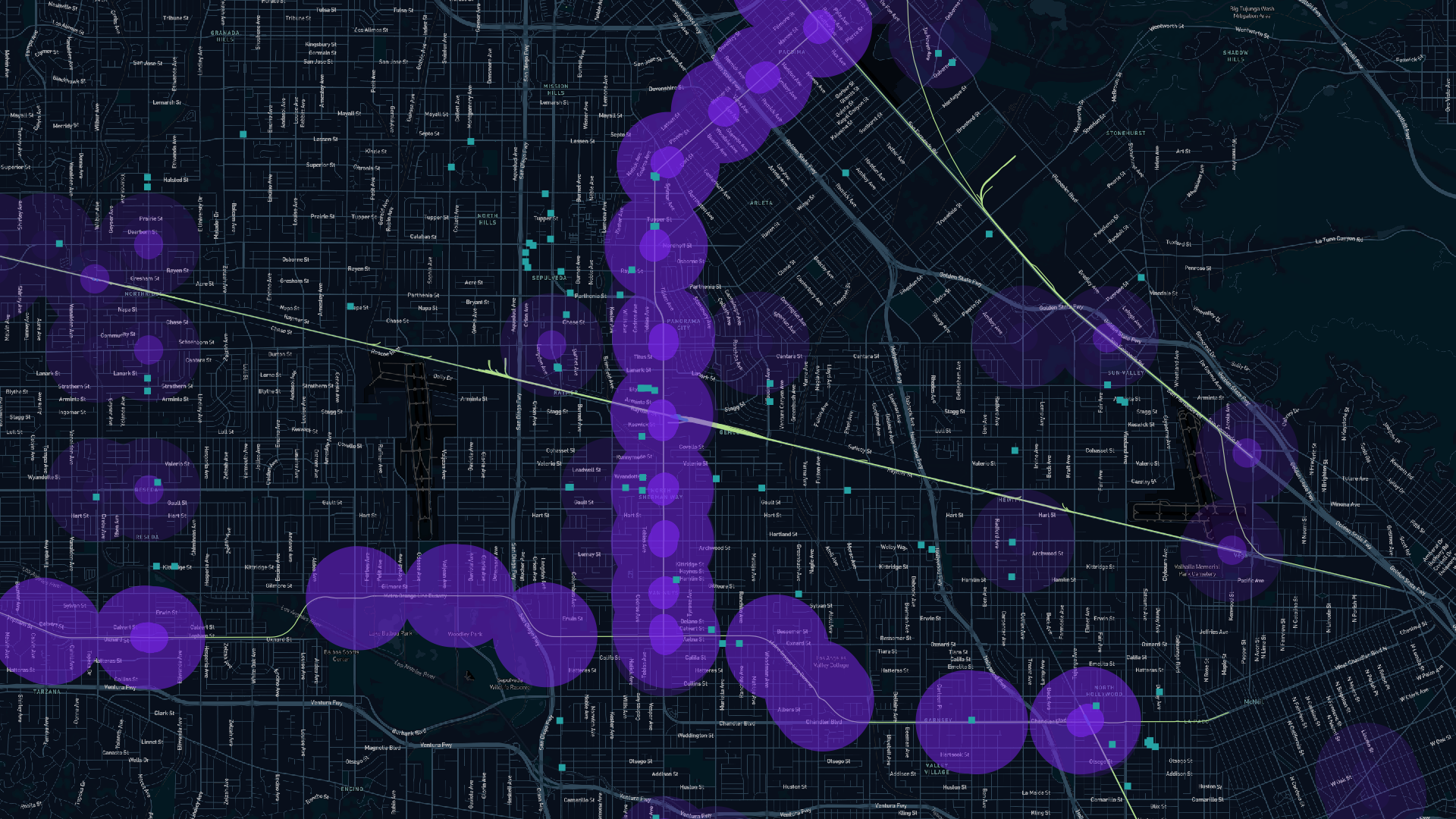
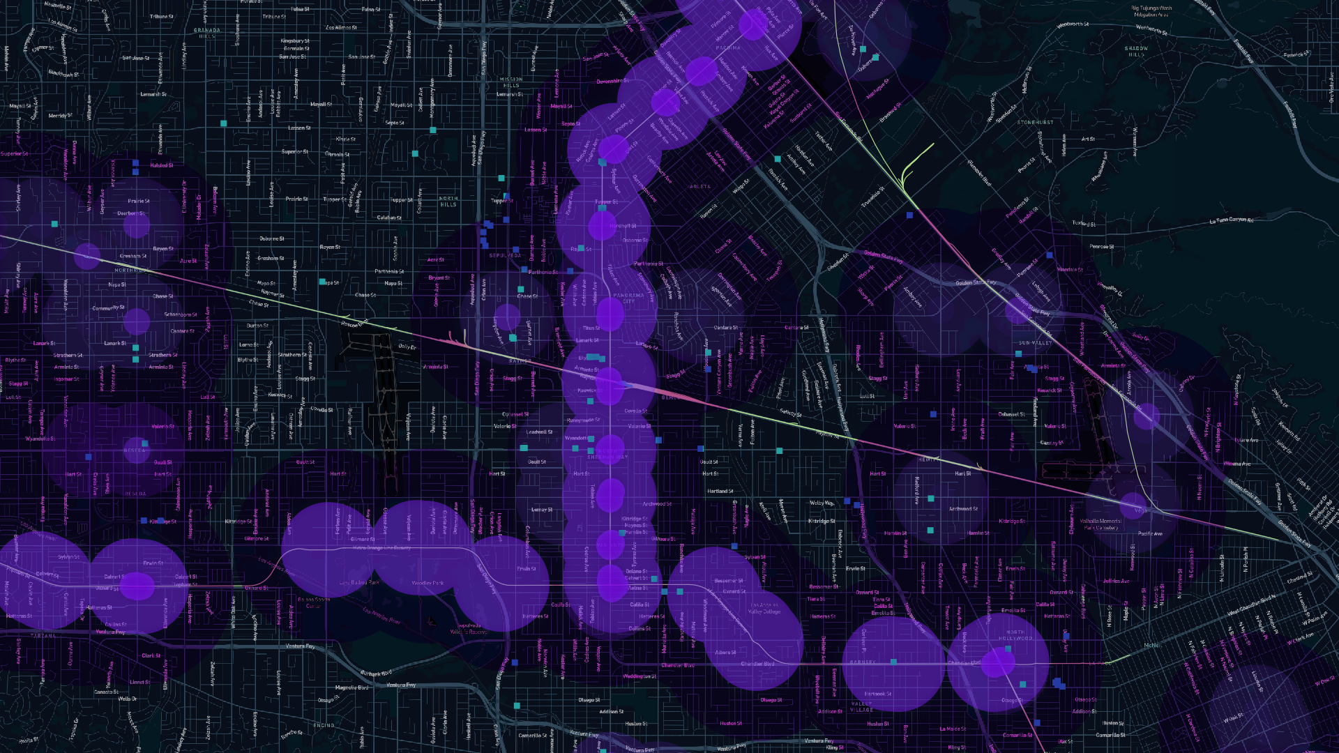
Solarpunk Community and Eco-speculation uses machine learning methods to explore how solar panel installation can impact ADUs development. California requires solar panels on newly-built homes, including most detached ADUs, according to Title 24 (California Building Energy Efficiency Standards). This requirement, which can be seen as a burden, actually creates an opportunity for communities to establish their own energy production through individual and pooled solar resources. The project goal was to develop a PV coverage strategy that can help residents maximize long-term cost savings on electricity, which could help offset ADU costs or be banked as a shared community resource. With the help of AI technology, homeowners can determine the location of ADUs and PV panels efficiently and ultimately maximize potential profit. This project also offers architects an opportunity to look at the big picture and rethink approaches to design and policy making.
The team’s used neural networks trained on satellite maps to site ADUs and also statistically estimated maximal solar energy production in a target area. They visualized solar roof conditions for the speculation with the help of Pix2Pix neural network training and a collective image dataset of parcels and neighborhood blocks. Lastly, they used their platform to evaluate how new collective solar energy production would affect neighborhoods across various scales. Satellite images processed in neural networks were used to determine solar efficiency area based on the color brightness and calculated image color ratios for valid solar roof area estimation. The team also collected relative electricity rates and solar installation costs to estimate the financial reward of installing solar panels on new ADU development.

GROUP 4
A Hot Take on ADUs: Simulating Canopy and Pervious Surfaces as a Step Towards Environmental Justice
Valeria Ospital, Daniel Shweiri, Chun-yi Wu
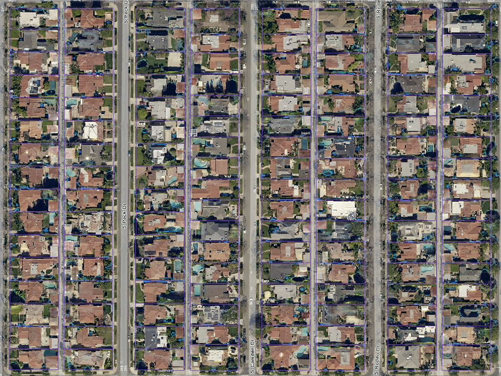
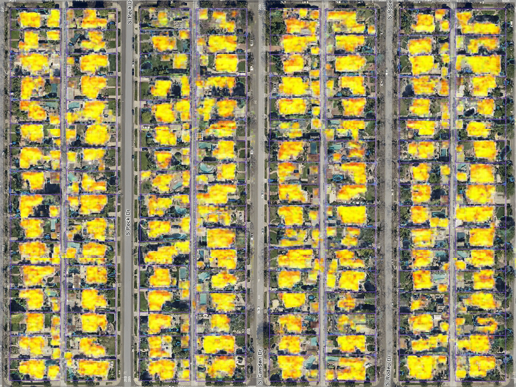
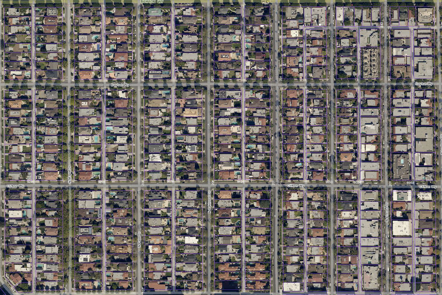
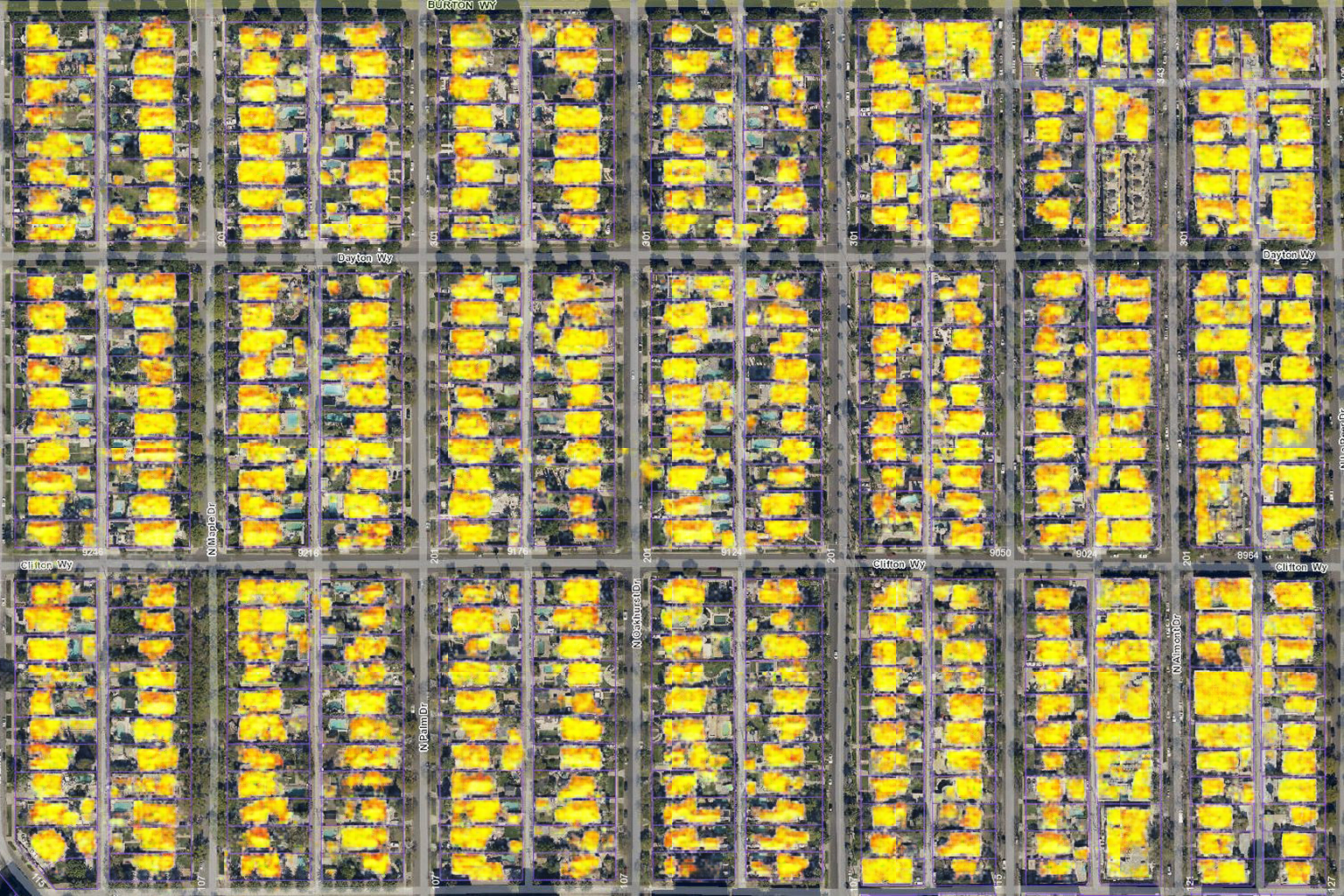
A Hot Take on ADUs investigates the impact of backyard housing on overall urban heat gain. As an infill development model, ADU construction decreases green surface and tree canopy potentially increasing urban temperature. Given that health risk due to heat is already unequally distributed, with poorer neighborhoods more greatly impacted, ADU construction should go hand-in-hand with heat-reducing measures.
The project compares the qualities of low-temperature versus high-temperature neighborhoods, in order to make visible the importance of canopy and pervious surfaces for environmental justice, and simulates this change from the lot to the city.
Satellite images from four low-temperature neighborhoods and four high-temperature neighborhoods in San Fernando Valley were used to train a CycleGan network, mapping the features from the former into the latter. In order to compare the effect of these transformations on heat production, the original and the projected images are processed through a Pix2Pix network that produces the corresponding heatmap.
Even though some canopy and green surfaces were added by the CycleGan transformation, its effect on heat couldn’t be projected. Nevertheless, this opens the discussion about which closer approach scales can be used to collect heat data.
GROUP 5
More in My Backyard!
Heena Patel, Jonah Klinghoffer, Nikhil Bang, Yangfan Xiao
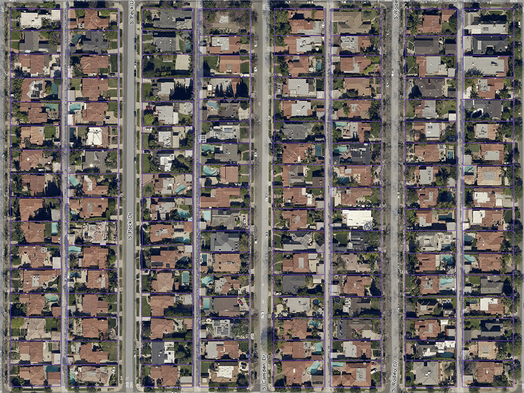
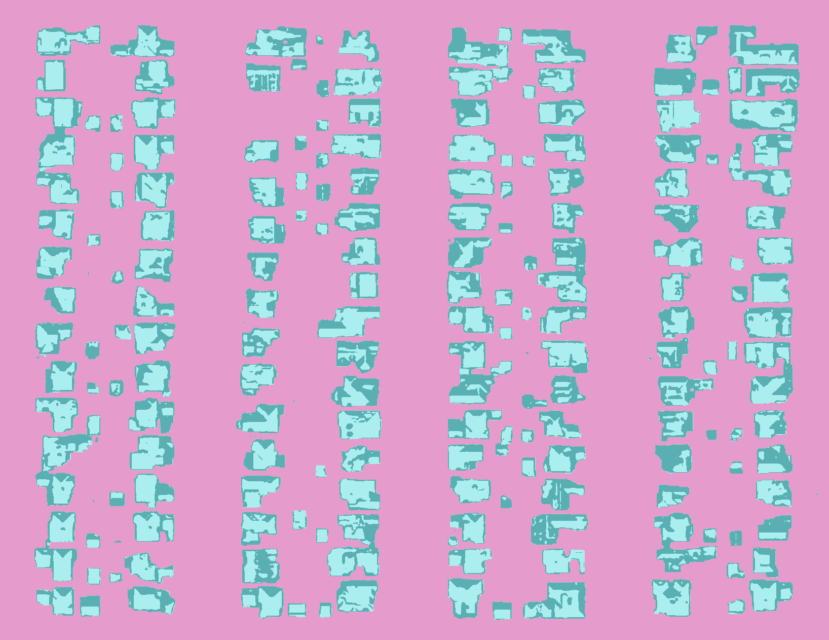
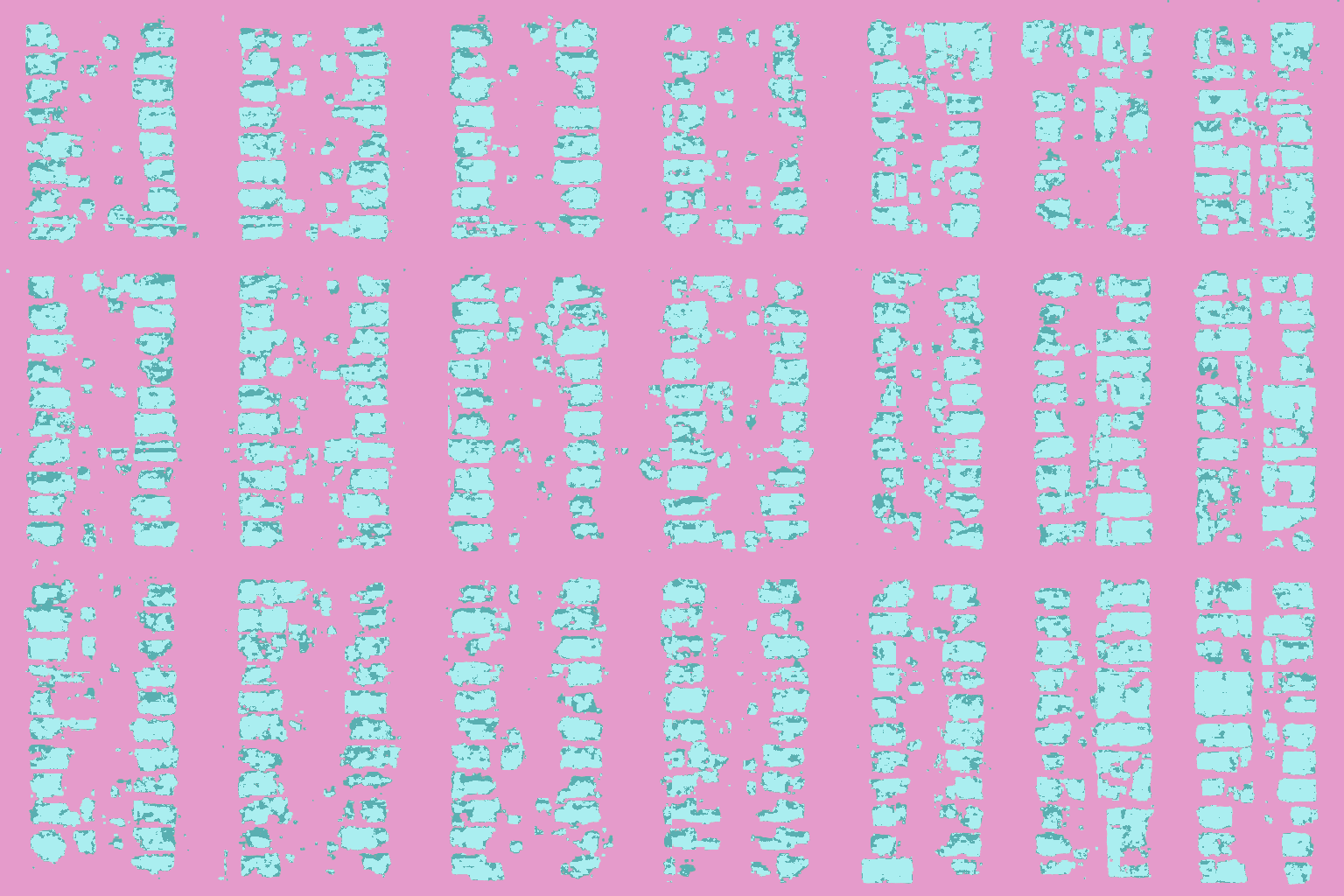
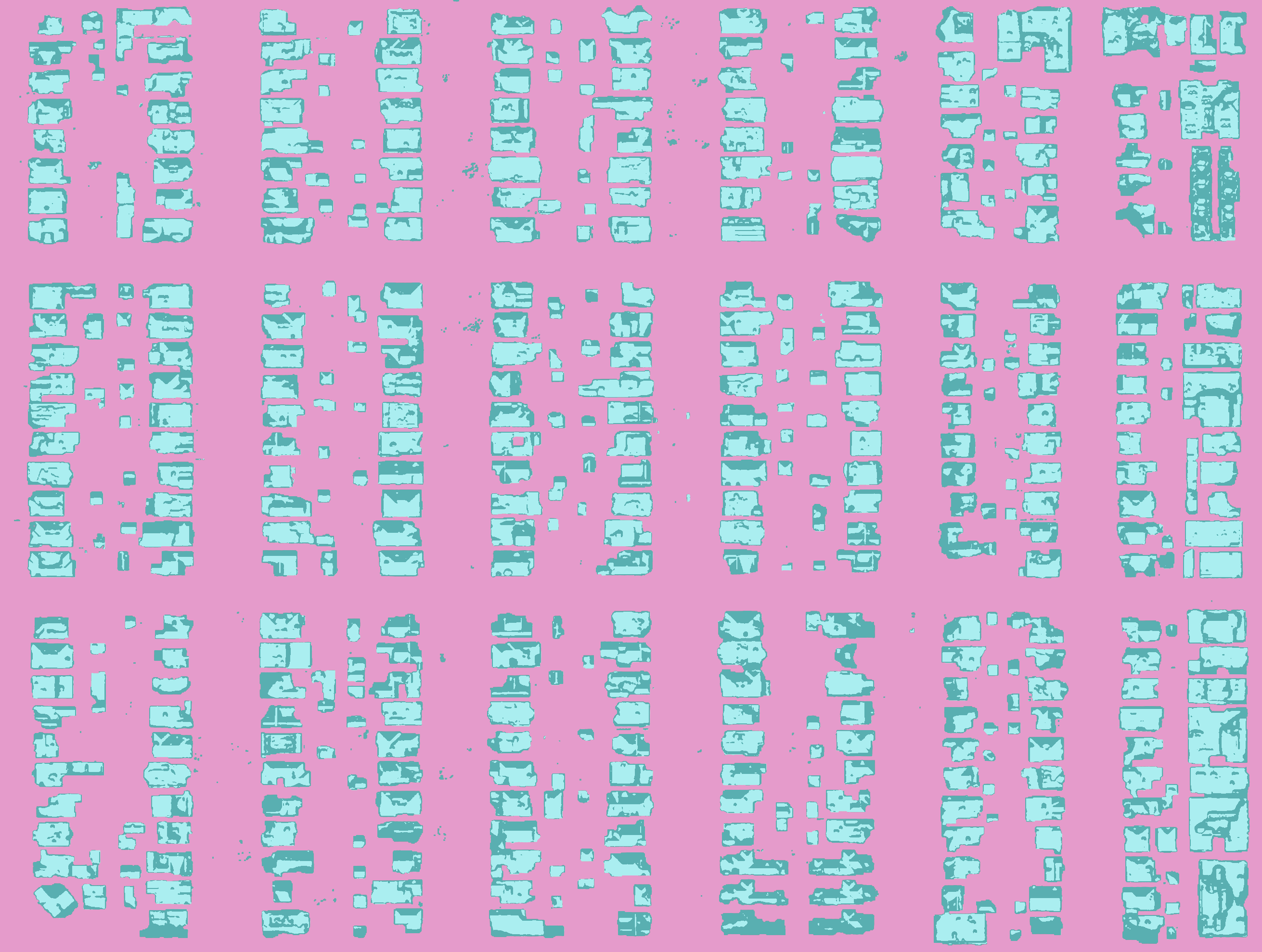
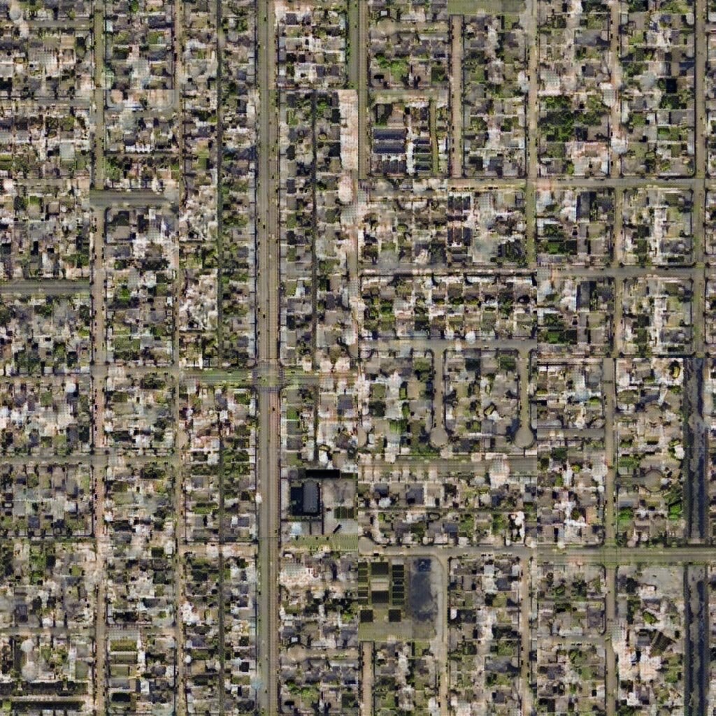
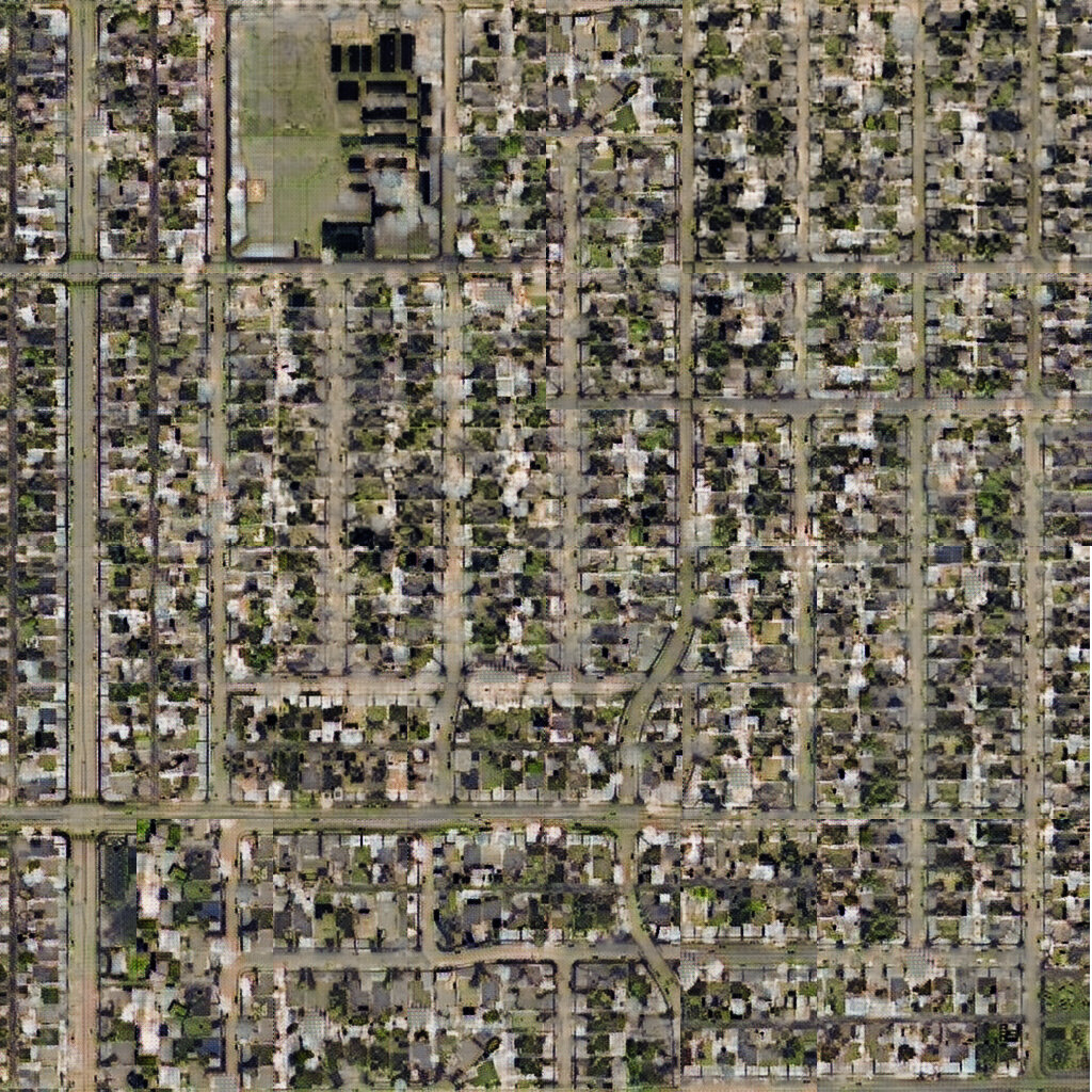
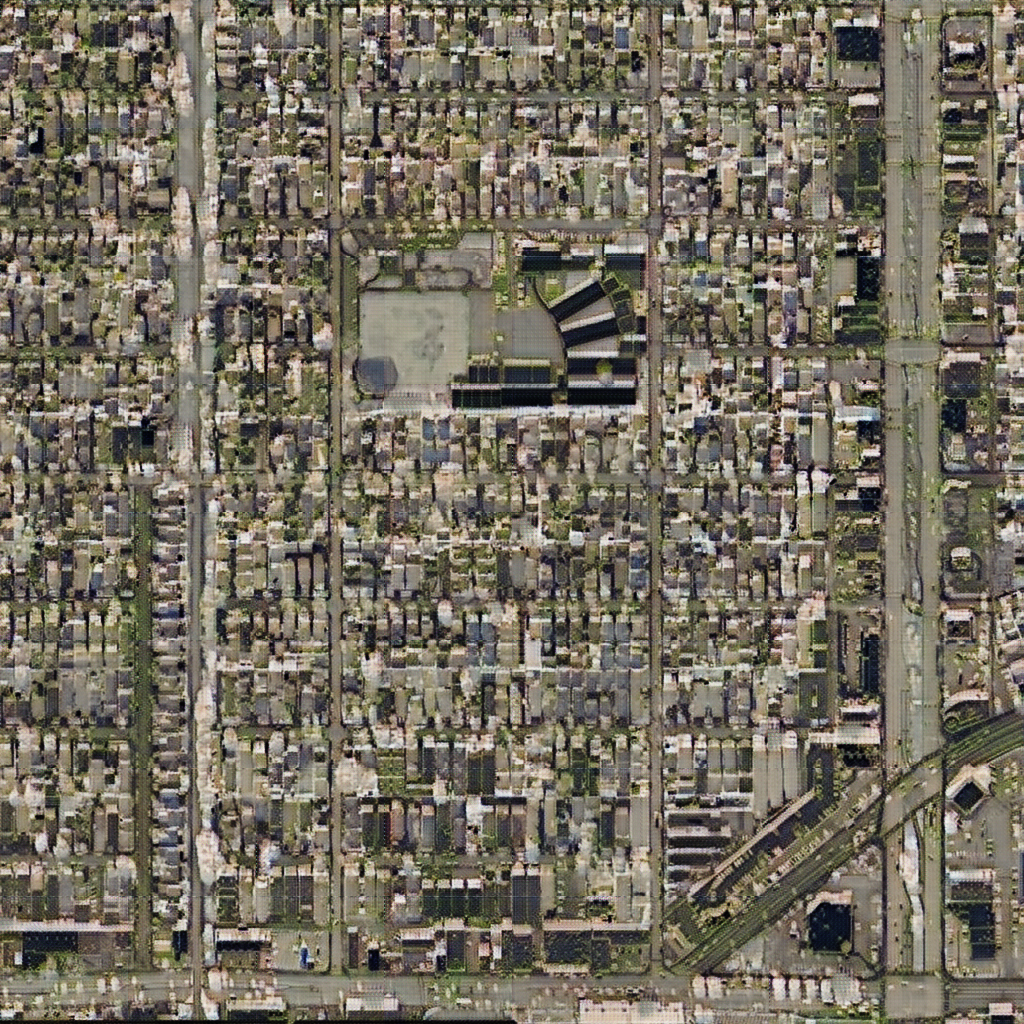
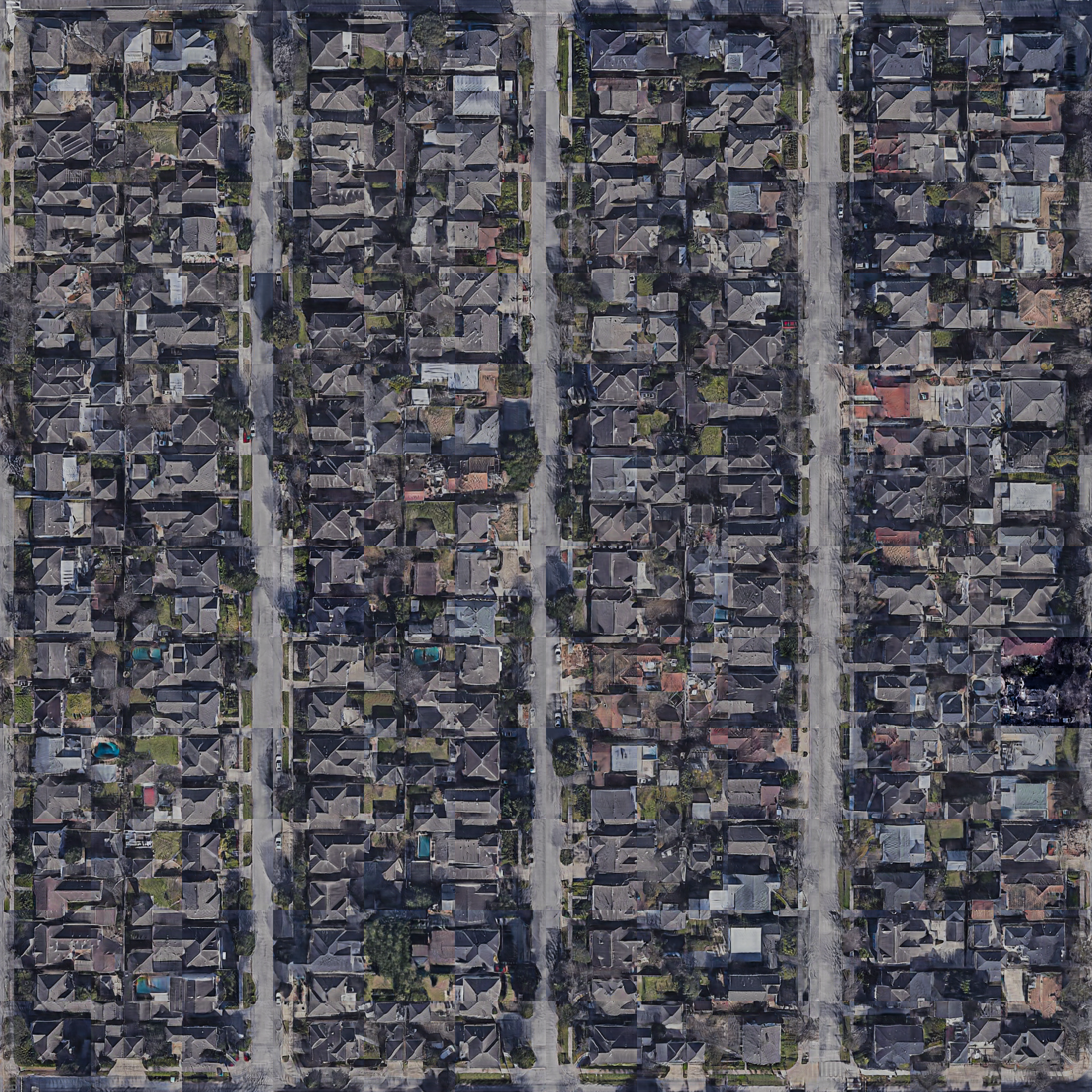
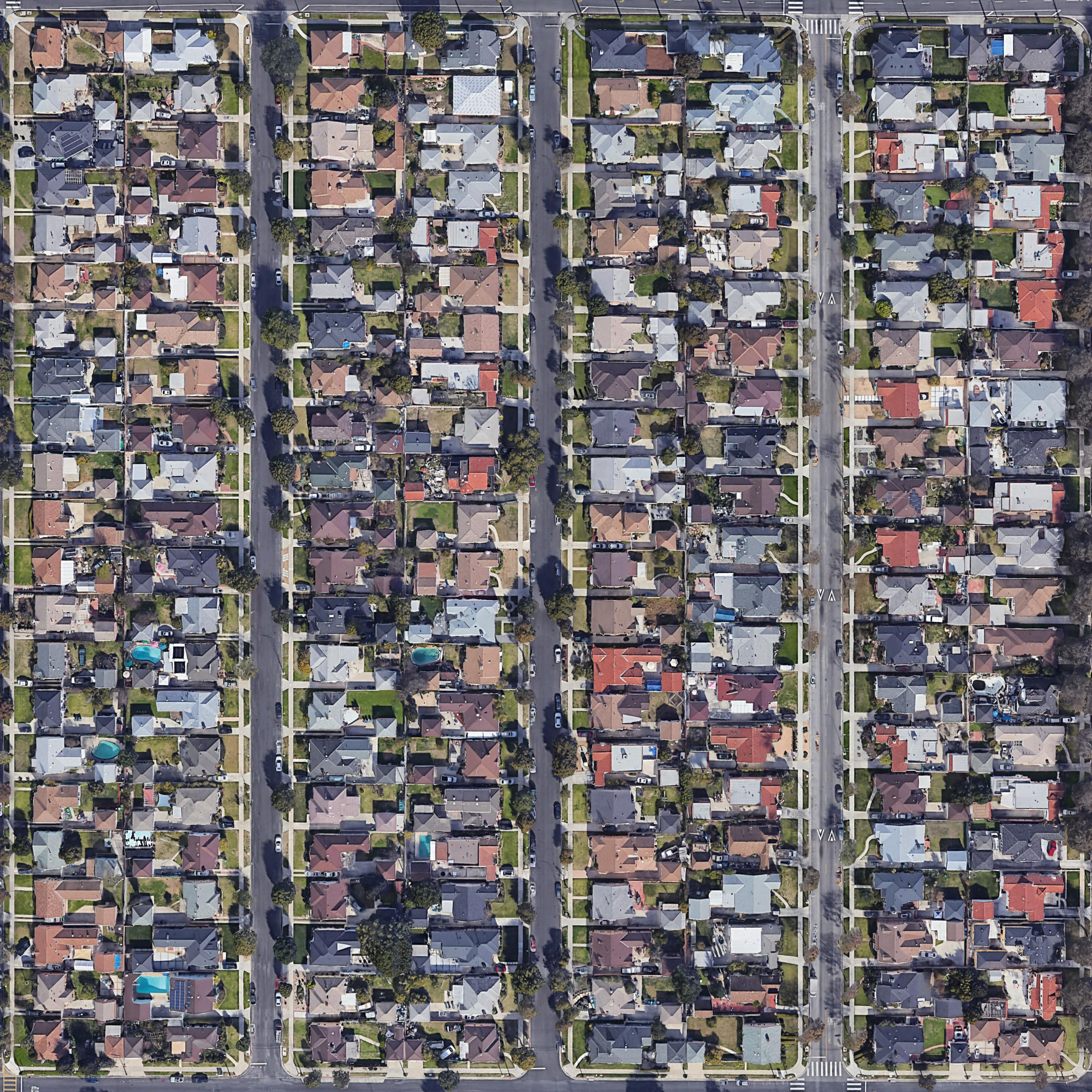
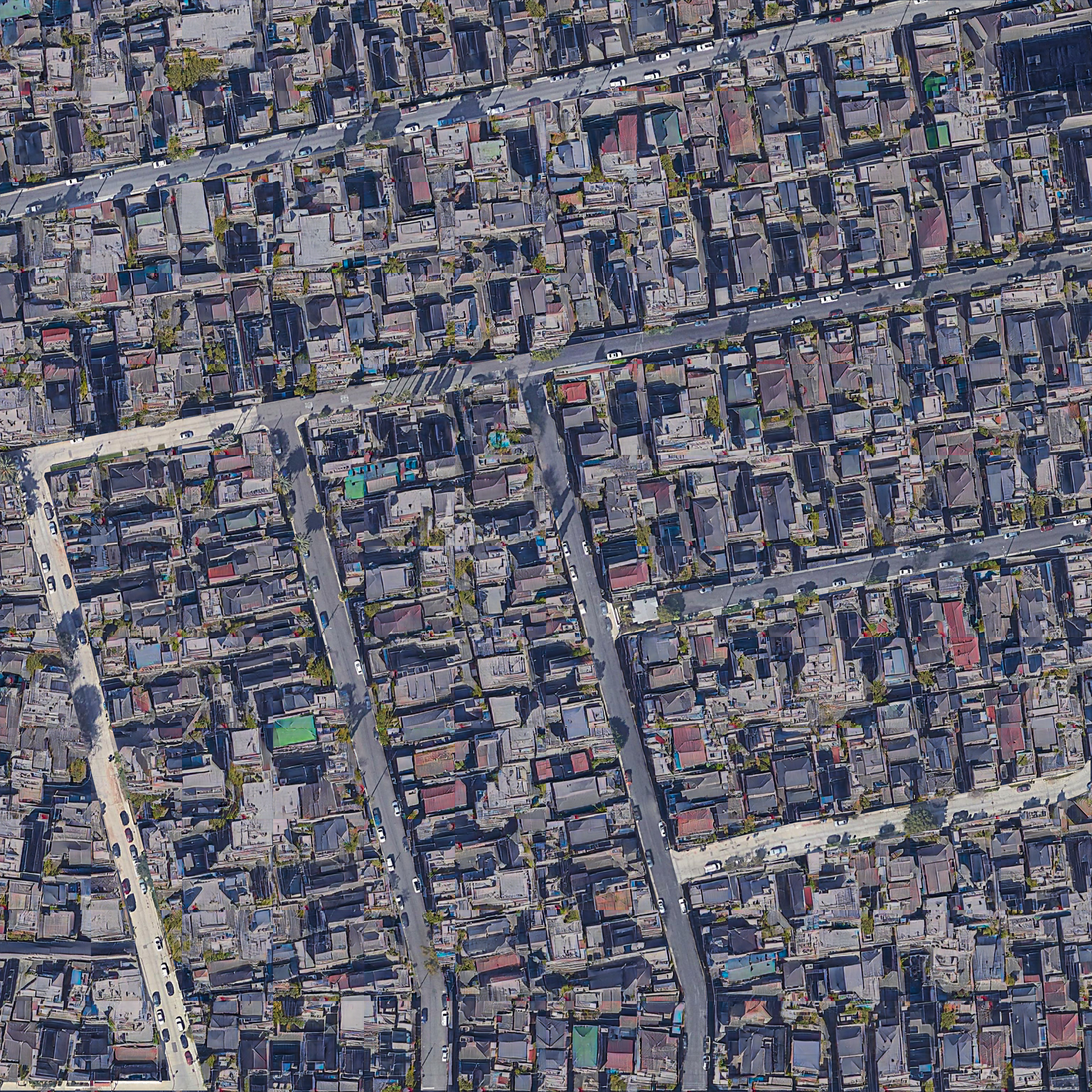
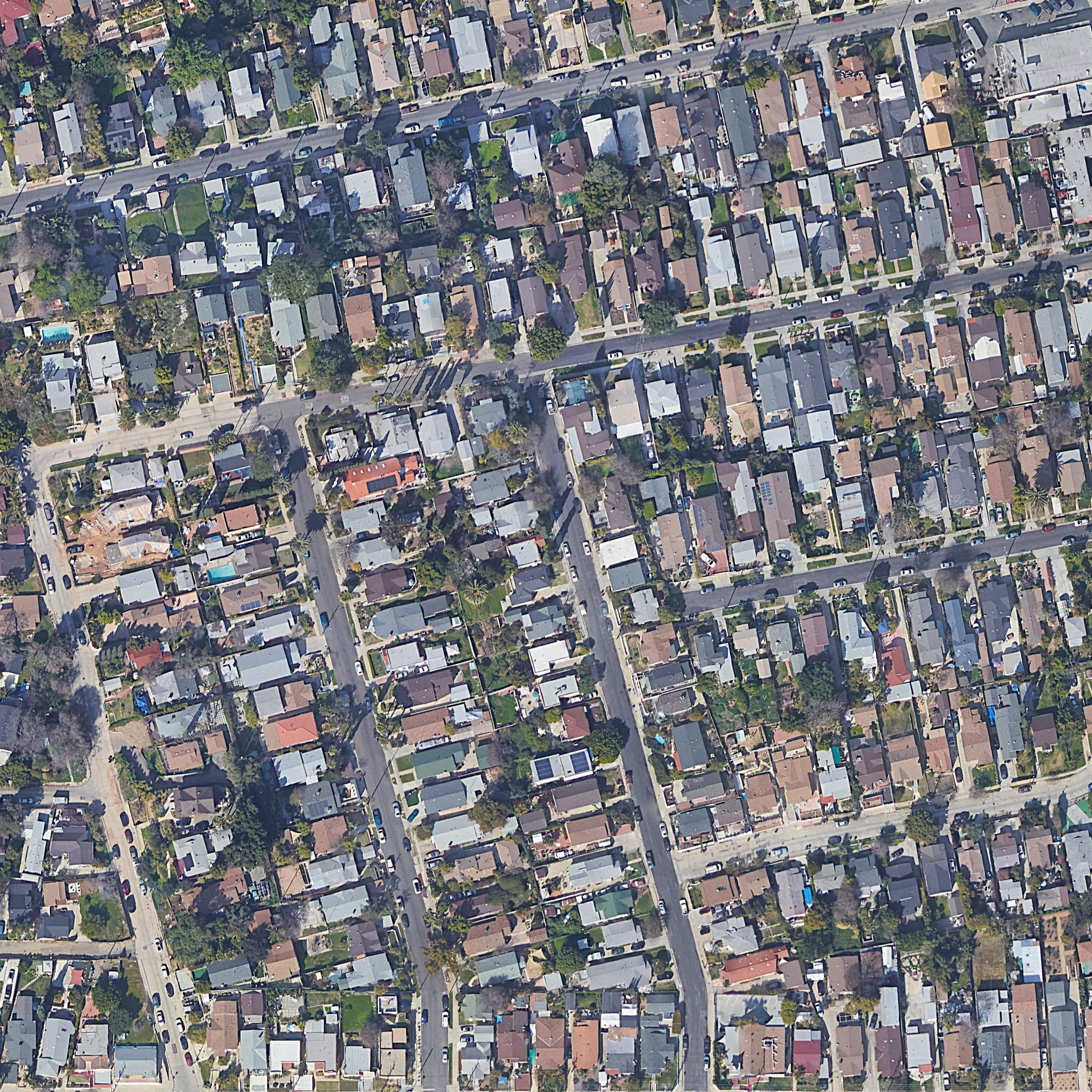
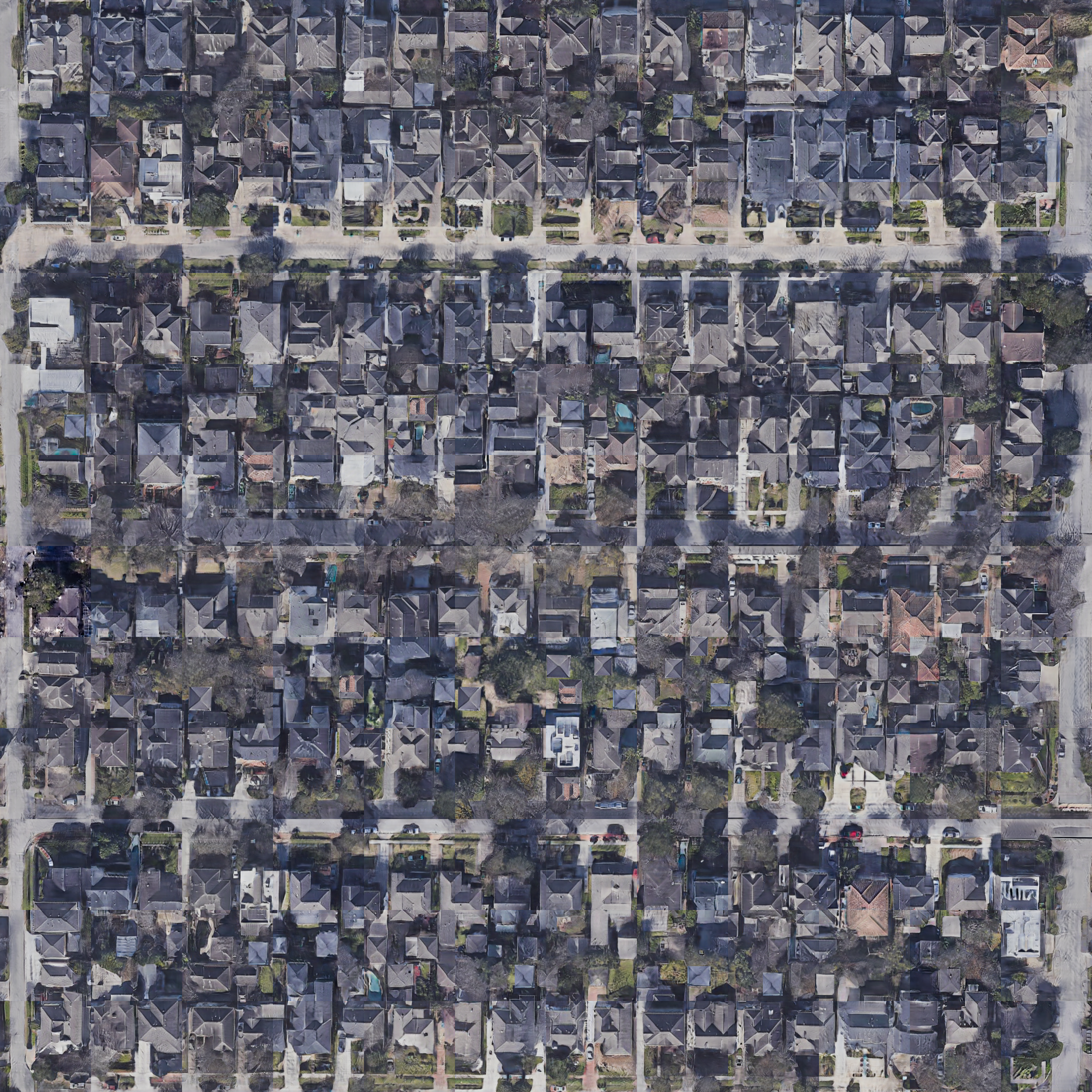
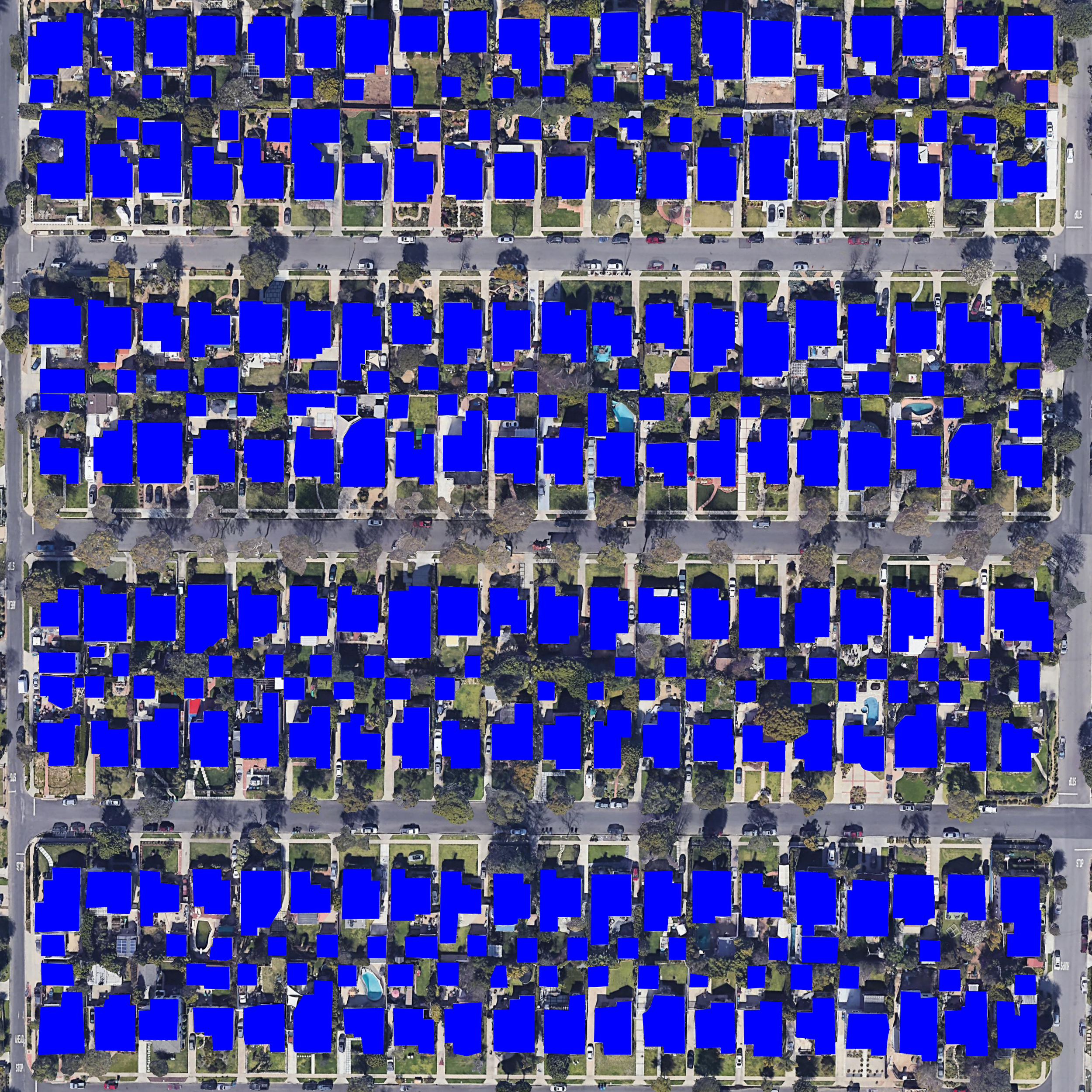
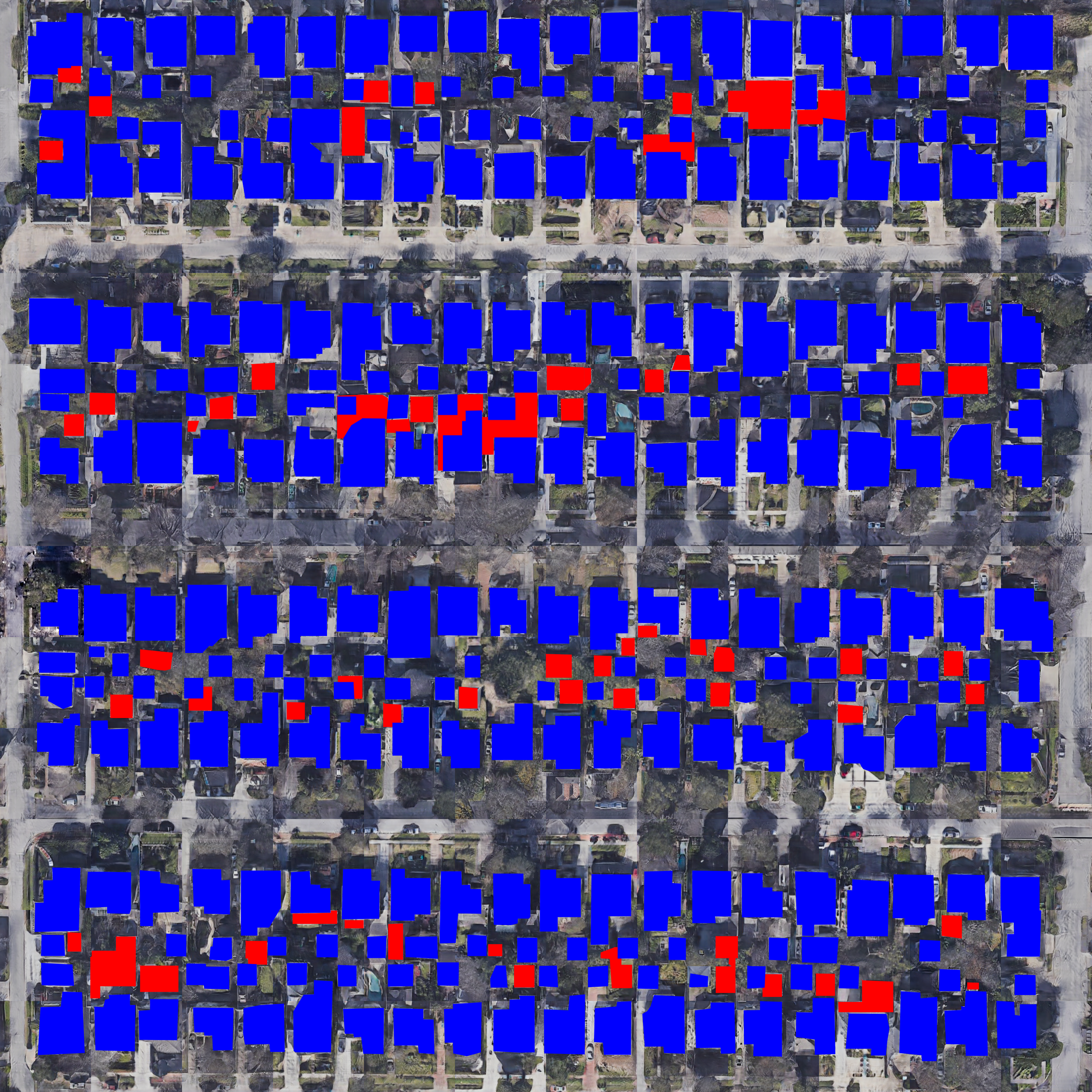
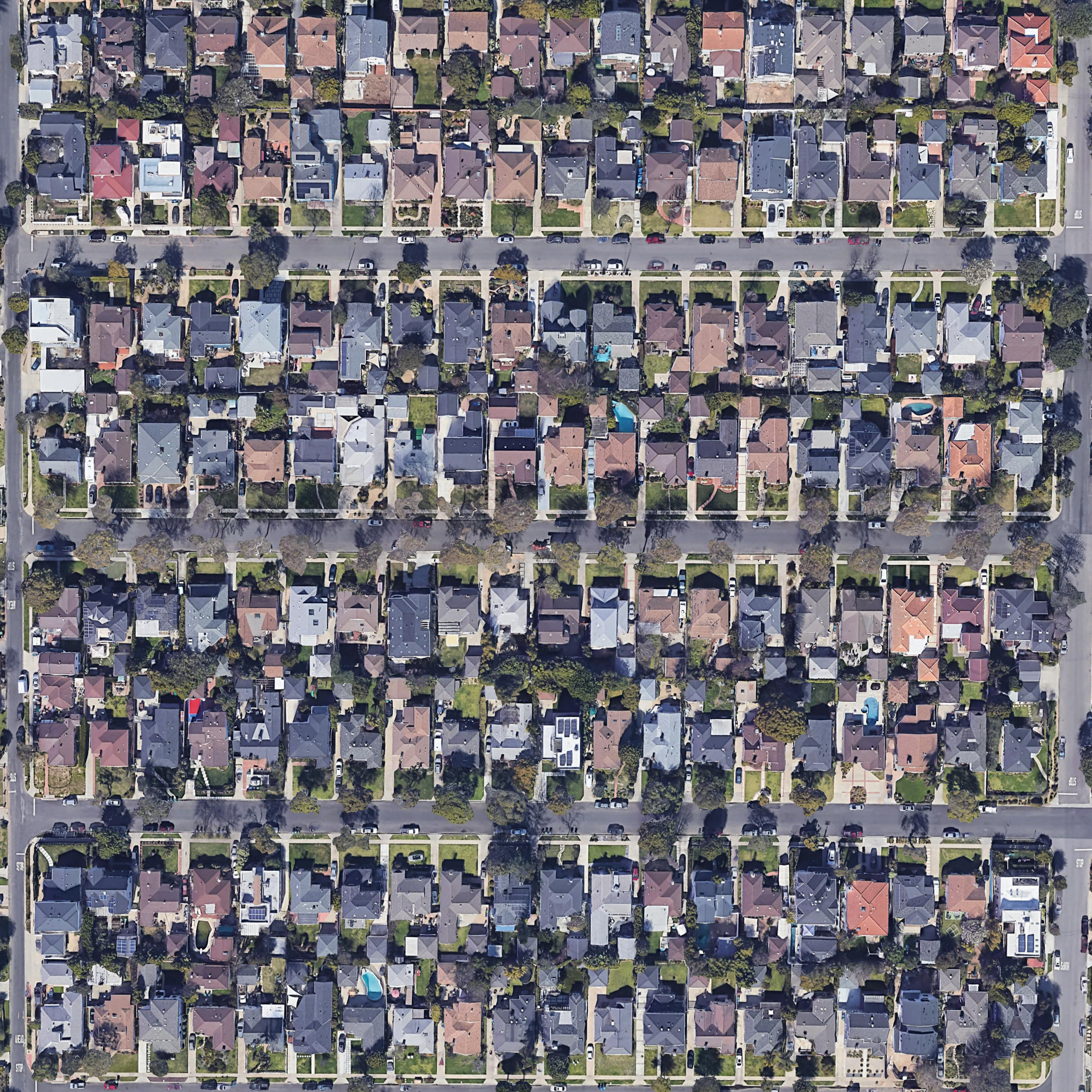
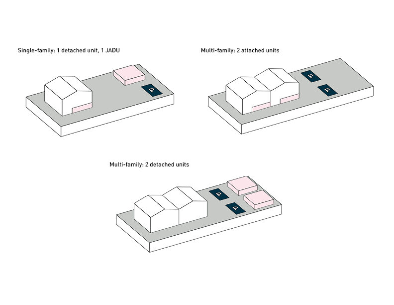
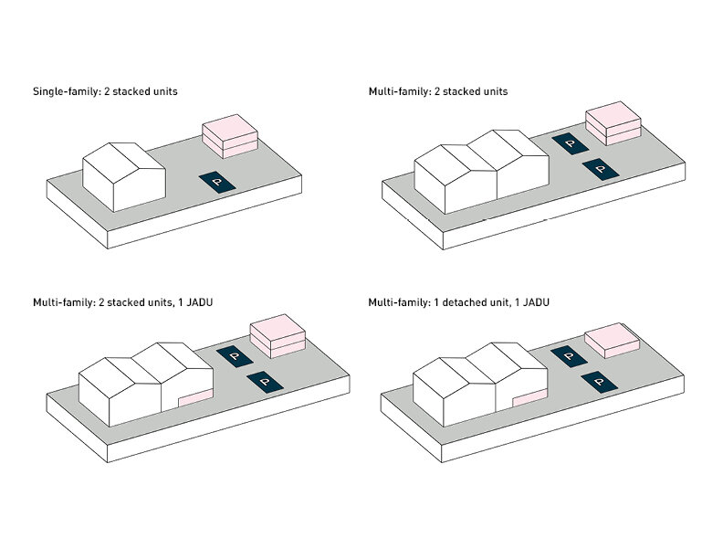
More in My Backyard! studies urban densification and legacies of single-family versus multi-family zoning. The absence of affordable housing and the high cost of living in Los Angeles are constant battles in the city, leading to issues of homelessness and eviction as the population of Los Angeles continues to increase. Recent 2020 California state laws are allowing the construction of multiple accessory dwelling units on both single-family and multi-family property lots in the county. This potential phenomenon of ADU hyper-densification could prove to be an effective step in reshaping the idea of communal living on a property lot at the micro-scale, as well as assist in the holistic densification of LA neighborhoods at the macro-scale.
A handful of cities around the world which have undergone urban densification were studied as precedents, including Tokyo, Mumbai, Mexico City, and Houston. A trained image classifier neural network was generated to apply such cities’ urban fabric on several LA neighborhoods. These outcomes allowed for speculation of extreme scenarios of ADU densification in the backyards of multi-family neighborhoods. The before and after image comparison of Mar Vista (LA) – Shady Acres (Houston) illustrates a hypothetical yet realistic alternate future of housing, as it would add an approximate 10% increase of secondary units in the area. The neural network training could further be expanded to images of elevations and perspectival views in order to explore ADU densification as a stacked construction.
Neural network Description :
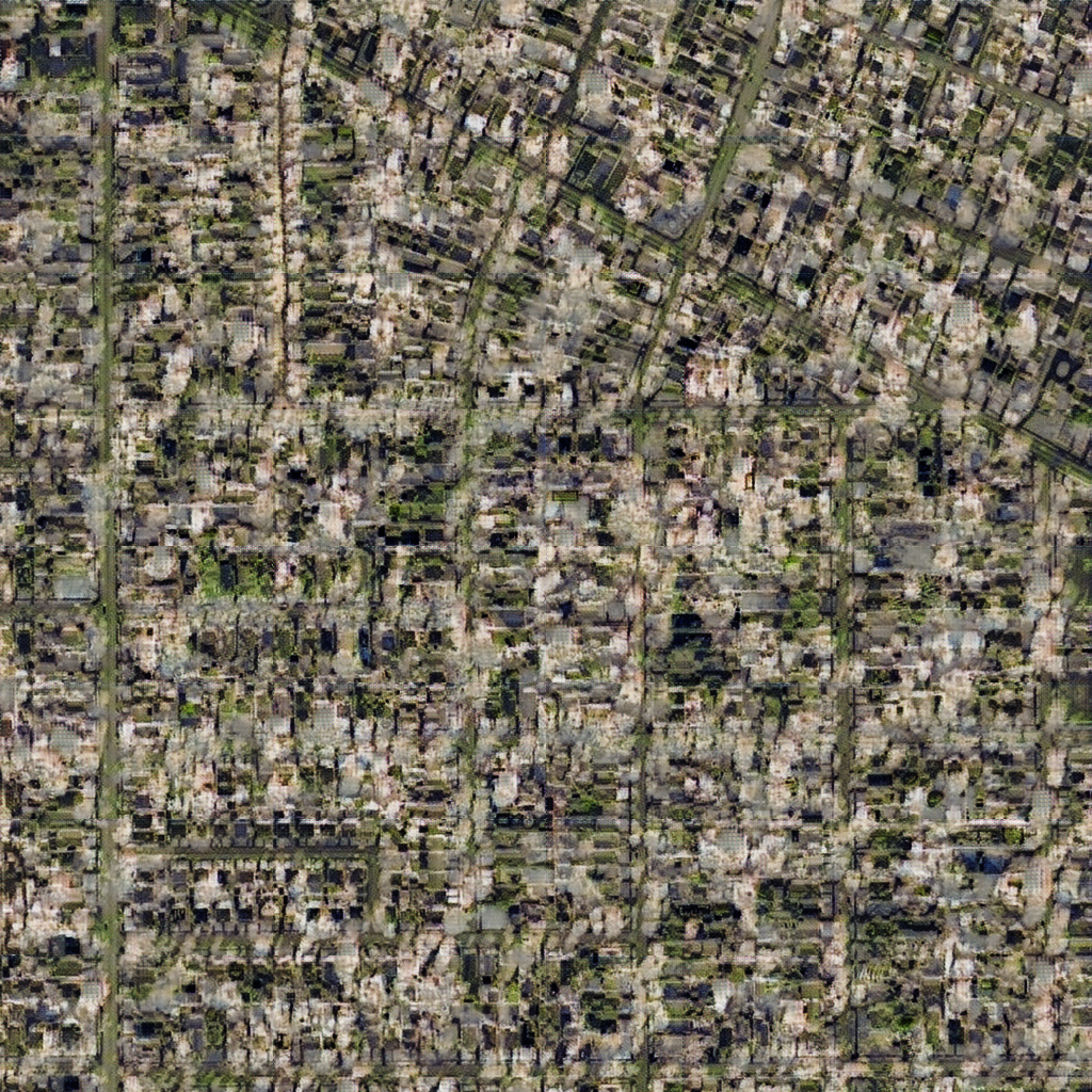
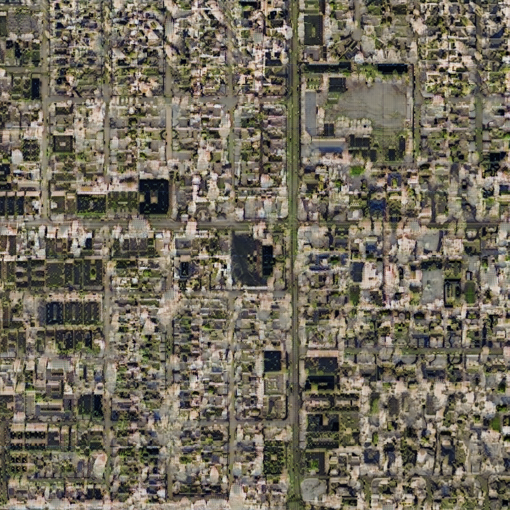
Step 1: Using cycleGAN as a neural network tool to feed fragmented images of LA neighborhoods with a combination of dense cities around the world.
Step 2: Speculating the outcome using processing to calculate the added density.
Funded by: Google AMI